Exploring Mallorca by bike is one of the most rewarding ways to experience the island, and having the right app on your phone can make every ride smoother, safer, and more memorable. The best apps for tracking your rides in Mallorca are Strava, Komoot, and Garmin Connect, each offering reliable GPS tracking, route planning, and offline map support. For casual riders, Komoot tends to edge ahead thanks to its downloadable maps and beginner-friendly route suggestions, while Strava suits those who enjoy logging performance data and connecting with other cyclists. Below, we answer the most common questions riders ask before heading out on Mallorcan roads.
Which cycling apps work best without mobile data in Mallorca?
The best cycling apps for use without mobile data in Mallorca are Komoot, Garmin Connect, and Maps.me, all of which allow you to download maps and routes to your device before you leave your hotel. This offline functionality is essential in Mallorca, where mobile coverage can drop in the Serra de Tramuntana mountains and along quieter rural roads away from the coast.
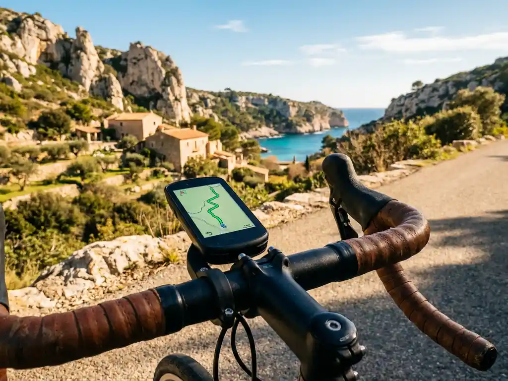
Komoot is particularly well suited for this. Before your ride, you simply download the region of Mallorca as an offline map pack, and the app will continue to give you turn-by-turn navigation even when your phone has no signal. Garmin Connect works similarly if you are using a Garmin cycling computer, syncing routes to the device so you are never dependent on a live data connection. Maps.me is a free alternative worth having as a backup, especially for riders who want to explore smaller roads and villages without worrying about data costs.
One practical tip: download your maps and planned routes the evening before, while connected to your hotel Wi-Fi. This takes only a few minutes and means you can ride with full confidence regardless of signal strength.
Does Strava work well for cycling in Mallorca?
Yes, Strava works very well for cycling in Mallorca. The island has a large and active Strava community, with thousands of segments already mapped across popular climbs like Sa Calobra, Puig Major, and the Cap de Formentor road. This means you can compare your times against other riders and track your progress on iconic routes throughout your stay.
For GPS cycling tracking in Mallorca, Strava records your speed, distance, elevation, and heart rate if you use a compatible sensor. The app’s heatmap feature also shows you which roads other cyclists use most frequently, which is a genuinely useful way to discover well-loved routes you might not have found on your own.
Where Strava is less strong is in pre-ride route planning for unfamiliar roads. It does offer a route builder, but the experience is not as intuitive as dedicated navigation apps. Many riders use Strava alongside Komoot, letting Komoot handle the navigation while Strava records the activity in the background. Both apps can run simultaneously on most smartphones without significant battery drain, provided you reduce screen brightness and turn off unnecessary notifications.
What’s the difference between Komoot and Strava for route planning?
The key difference between Komoot and Strava for route planning is their primary purpose. Komoot is built around navigation and route discovery, making it the stronger tool for planning and following a new route. Strava is built around performance tracking and social comparison, making it the stronger tool for logging your ride and measuring improvement over time.
Komoot for route planning
Komoot excels at helping you build a route from scratch or choose from curated community highlights. You can filter routes by surface type, difficulty, and distance, which is especially useful on Mallorca, where you might want to avoid gravel sections or specifically seek out quieter back roads. The app also gives you a realistic elevation profile and estimated duration before you set off, so there are no nasty surprises halfway up a mountain pass.
Strava for route planning
Strava’s route builder is functional and benefits from the platform’s enormous dataset of real rider activity. Its suggested routes tend to follow roads that other cyclists already use, which is a reasonable quality filter. However, the turn-by-turn navigation experience is less polished than Komoot’s, and offline access to planned routes requires a paid Strava subscription. For casual riders who simply want to follow a pre-planned cycling route in Mallorca without fuss, Komoot is generally the more straightforward choice.
How do you record a cycling route and share it with others?
To record a cycling route and share it with others, open your chosen GPS cycling app before you start riding, press record, and let the app track your movement throughout the ride. Once you finish, save the activity and use the app’s built-in sharing tools to export the route as a GPX file or share a link directly with friends.
In Strava, saved activities are automatically visible to your followers, and you can share a public link to any ride. In Komoot, you can publish a completed tour to your profile and share it via a direct link or export it as a GPX file that others can import into their own apps or cycling computers.
GPX files are the universal format for sharing cycling routes, and almost every major platform accepts them. If you are riding with a group and want everyone to follow the same path, one person can plan the route in Komoot or Strava, export the GPX file, and share it via a messaging app so each rider can import it to their own device before the ride begins. This is a common approach among cycling groups visiting Mallorca, where coordinating a shared route in advance saves time and avoids confusion at junctions.
What should you look for in a cycling tracking app as a casual rider?
As a casual rider, the most important features to look for in a cycling tracking app are offline map support, simple navigation, automatic activity recording, and an easy-to-read interface. You do not need advanced power metrics or race analysis tools. What matters is that the app reliably records your ride, keeps you on the right road, and lets you look back on where you have been.
- Offline maps: Essential for riding in areas with patchy mobile coverage, particularly in the Mallorcan mountains.
- Turn-by-turn navigation: Audio cues or clear on-screen directions so you can keep your eyes on the road rather than your phone screen.
- Automatic pause: The app should detect when you stop for a coffee or a photo and pause recording automatically, so your average speed reflects actual riding time.
- Battery efficiency: GPS tracking drains your phone quickly. Look for apps with a low-power mode or use a dedicated cycling computer for longer rides.
- Simple sharing: The ability to share your route or activity with friends or family back home adds a social dimension to your rides without requiring technical knowledge.
For most recreational cyclists visiting Mallorca, Komoot covers all of these bases in a single free app. If you enjoy a light social element and want to see how your rides compare to others on the same roads, adding Strava as a secondary recording app is a natural next step.
If you prefer to leave the route planning entirely to someone else and simply enjoy the ride, our guided cycling tours take care of everything. Our Easy Riders group rides, covering 50 to 60 kilometres at a relaxed pace of around 20 kilometres per hour, are a wonderful way to discover the island’s most scenic roads without needing to navigate at all. And if you have questions about what to expect or how to prepare, feel free to get in touch with us before your trip.